The Port of Newcastle
Newcastle upon Tyne, commonly known as Newcastle, is located in the North East of England on the north bank of the River Tyne. DFDS Seaways operates the Newcastle to Amsterdam ferry, with 7 weekly crossings that take around 15 hours and 30 minutes.
| Cross channel operators |
Departure |
Destination |
Weekly Crossings |
Duration |
 DFDS Seaways DFDS Seaways |
Amsterdam |
Newcastle |
7 |
16h 30min |
| |
|
|
|
|
| GPS co ordinates |
Latitude |
Longitude |
| Newcastle Ferry Port |
54º59'31.4" N (54.99205 N) |
1º26'59" W (-1.44972 E) |
| |
|
|
Newcastle Ferry Port by Car
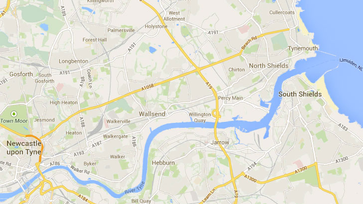
Your destination is the Royal Quays, east of Newcastle. When coming from north or south you can get there following the A19 to Tyne Tunnel roundabout, north of the River Tyne, and just follow signs to ferries & North Sea. If you're coming from the west follow signs to Newcastle and then get to the A1058 following signs for coast. Signs to ferries & North Sea will lead you to the Royal Quays.
Updated:
2 August 2026
by Paul Quigley