The Port of Amsterdam
Amsterdam is the capital city of the Netherlands, its financial and cultural centre and the largest city in the country. It lies on the banks of the IJ Bay and the Amstel River. DFDS Seaways operates a weekly crossing between Amsterdam and Newcastle with an estimated duration of 16 hours and 30 minutes.
| Cross channel operators |
Departure |
Destination |
Weekly Crossings |
Duration |
 DFDS Seaways DFDS Seaways |
Newcastle |
Amsterdam |
7 |
15h 30min |
| |
|
|
|
|
| GPS co ordinates |
Latitude |
Longitude |
| Amsterdam Ferry Port |
52º27'46.6" N (52.46294 N) |
4º35'7.7" E (4.58546 E) |
| |
|
|
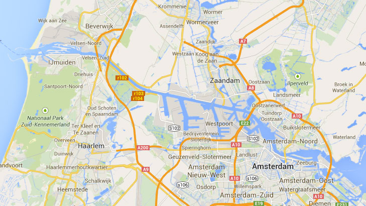
Amsterdam Ferry Port by Car
Amsterdam Ferries dock at IJmuiden, a port situated 18 miles west from Amsterdam city. The best way to get there is taking the A9 and then exit to A22 (IJmuiden/Beverwijk). Take the IJmuiden exit and follow the signs to the ferry terminal after driving alongside the "Noordzeecanal".
Updated:
3 August 2026
by Paul Quigley