The Port of Zeebrugge
Zeebrugge is a harbour town north of Bruges with a modern international ferry port. P&O Ferries operates the Zeebrugge to Hull ferry route, with 7 weekly crossings and an average crossing time of 14 hours 30 minutes.
| Cross channel operators |
Departure |
Destination |
Weekly Crossings |
Duration |
 P&O Ferries P&O Ferries |
Hull |
Zeebrugge |
7 |
14h 30min |
| |
|
|
|
|
| GPS co ordinates |
Latitude |
Longitude |
| Zeebrugge Terminal |
51º20'25.8" N (51.34050 N) |
3º11'20.2" E (3.18893 E) |
| |
|
|
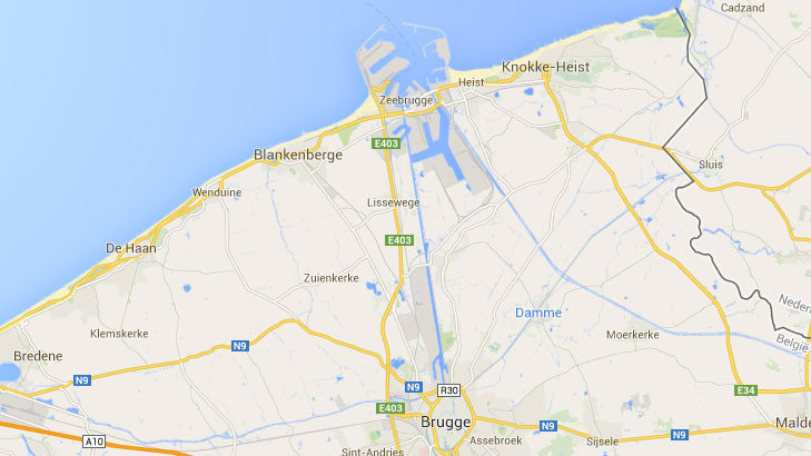
Zeebrugge Ferry Port by Car
When coming from the south take the E403 into Zeebrugge. The Zeebrugge Ferry Terminal is located at the outer dock (Buitenhaven), Leopold II Dam (Havendam). In Zeebrugge you only need to follow the signs 'Zone 1', 'Car ferries' and 'P&O Ferries/Hull'.
Updated:
2 August 2026
by Paul Quigley