The Port of Hook of Holland
Hook of Holland literally means "Corner of Holland".It's a town located in the western Netherlands. Its name refers to its location at the mouth of the Nieuwe Waterweg ship canal into the North Sea, in the southwestern corner of Holland.
Stena Line operates the ferry services between Hook of Holland and Harwich. 14 weekly crossings with a crossing time of around 6 hours 30 minutes.
| Cross channel operators |
Departure |
Destination |
Weekly Crossings |
Duration |
 Stena Line Stena Line |
Harwich |
Hook of Holland |
14 |
6h 45min |
| |
|
|
|
|
| GPS co ordinates |
Latitude |
Longitude |
| Hook of Holland Ferry Port |
51º58'32.9" N (51.97581 N) |
4º7'38.9" E (4.12748 E) |
| |
|
|
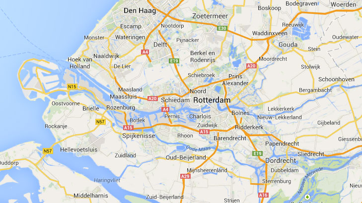
Hook of Holland Ferry Port by Car
The Hook of Holland is easily accessible using the E30 and E25 network of motorways. These motorways link The Hook of Holland to Amsterdan, Rotterdam and the rest of the Netherlands. Look out for the signs to Hook van Holland.
Updated:
2 August 2026
by Paul Quigley